Floods/Route Update
Loyn Bridge (across the River Lune between Gressingham and Hornby) is closed again for repair work on its masonry piers and cutwaters. Diverting to the end of the cycle path from Crook O’Lune (mile marker 7 on Sustrans map) past Caton as far as the Bull Beck picnic site, then carefully take the busy A683 for approximately 3 mile before turning right on to the B6480 towards Wray. The route can be re-joined in Wray.
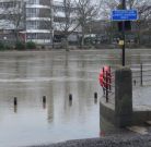
The riverside path into York is still underwater, so go up Stripe Lane (mile marker 104) and cross the A19 in Skelton to use the shared path into the city centre (the route can be found again near the Minster).
The Sustrans Way of the Roses map will help identify these locations and, depending on what the weather still has in store, any other necessary diversions. Local accommodation providers are usually a good source of up to date news.
