Terrain

From the Way of the Roses map, we’ve extracted the route’s profile broken down into sections ...so you can see where the big hills are!

The profiles also indicate the off-road sections of the route.

Until the new verge path alongside the busy A65 between Clapham and Austwick is built, the Way of the Roses uses a 1.5 mile off-road section of the Pennine Cycleway just to the north of these villages. It’s the roughest part of the route and you may decide to push your bike for some or all of it. 

There’s about a mile east of Dunnington (south of the A166 near York) that’s unmade earth and stone track but usually firm going. Otherwise, the off-road sections are well made. 


Route Profile - Morecambe to Cracoe


Route Profile - Cracoe to York


Route Profile - York to Bridlington


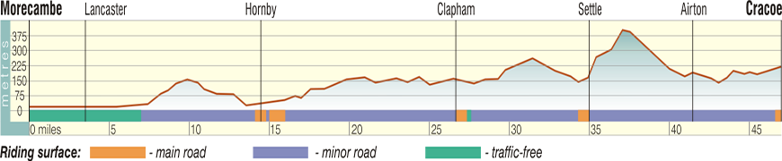
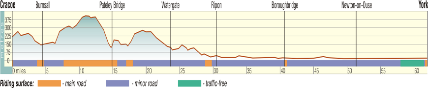
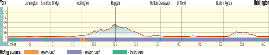
Reproduced with kind permission of Stirling Surveys. Images © Stirling Surveys 2010